
Table of Contents
Las Vegas to Grand Canyon South Rim distance: the National Park Service (NPS) gives 278 miles (447 km) by road. The route takes US-93 south to Kingman, I-40 east to Williams and Highway 64 (AZ-64) north to the South Rim. NPS does not give a drive time. Two OpenStreetMap route calculators (OSRM and Valhalla, run on 28 October 2026) put the trip from the Las Vegas Strip to Grand Canyon Village at 275 to 282 miles and about 4 hours 40 minutes to 5 hours 25 minutes without stops. Most people should plan for about 5 to 6 hours with fuel and food breaks. The West Rim (Skywalk) is much closer, at about 130 miles, but it is a Hualapai Tribe attraction and not part of the national park.
Last checked: 28 October 2026. The figures come from the NPS South Rim directions page, NPS park alerts, the Arizona Department of Transportation (ADOT) and the Hualapai Tribe’s Grand Canyon West FAQ. Where sources differ, both numbers are shown. This page is not based on a personal visit.
Important this autumn: the South Rim is open for day visits, but overnight lodging inside the park is suspended because of Stage 4 water restrictions after the 29 August 2026 flash flood. Hotels in Tusayan, just outside the park, are not affected (NPS). That makes a long day trip or a night in Tusayan or Williams the practical choices right now. Details are in the “Current conditions” section below.
Las Vegas to Grand Canyon South Rim distance and drive time at a glance
| Route | Distance | Drive time (no stops) | Source |
|---|---|---|---|
| Main route: US-93 > I-40 (Kingman to Williams) > AZ-64 | 278 mi (447 km) | Not given by NPS | NPS South Rim directions |
| Same route, Las Vegas Strip to Grand Canyon Village | 275–282 mi (443–454 km) | About 4 h 40 min – 5 h 25 min | OSRM and Valhalla (OpenStreetMap), 28 Oct 2026* |
| Las Vegas Strip to Tusayan (gateway town) | 268–275 mi (432–443 km) | About 4 h 30 min – 5 h 10 min | OSRM and Valhalla, 28 Oct 2026* |
| Route 66 variant: Historic Route 66 from Kingman via Peach Springs and Seligman, then I-40 and AZ-64 | 292–299 mi (470–481 km) | About 5 h 20 min – 6 h | OSRM and Valhalla, 28 Oct 2026* |
| Las Vegas to Grand Canyon West (West Rim, Skywalk) | About 130 mi | About 2.5 hours (FAQ); “two hour drive” (Plan Your Visit page) | Grand Canyon West (Hualapai Tribe) |
The route, step by step
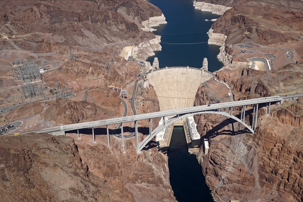
- Las Vegas to the Colorado River: I-11/US-93 south past Henderson and Boulder City. The highway crosses the river into Arizona on the Mike O’Callaghan–Pat Tillman Memorial Bridge, right beside Hoover Dam.
- US-93 to Kingman: about 102–109 miles and roughly 1 h 50 min – 2 h 10 min from the Strip (OSRM/Valhalla). US-93 joins I-40 in west Kingman.
- I-40 east, Kingman to Williams: about 115 miles (185 km) and roughly 1 h 40 min – 2 h (OSRM/Valhalla). Seligman and Ash Fork are on this stretch.
- AZ-64 north, Williams to the South Rim: NPS gives 63 miles (101 km) from Williams and also says the South Rim is “60 miles north of Williams”. The route calculators give about 60 miles and 1 h 10 – 1 h 20 min to Grand Canyon Village. The road passes Valle and Tusayan.
- South Entrance Station: NPS says it is about 1.6 miles (2.5 km) north of Tusayan and 4.9 miles (7.8 km) south of Grand Canyon Visitor Center.
Stopping at Hoover Dam on the way
The main route does not cross the dam itself; it uses the bridge. The Bureau of Reclamation says Hoover Dam is 30 miles southeast of Las Vegas. To visit, leave I-11/US-93 at Exit 2 and follow NV-172 (Hoover Dam Access Road). The parking garage on the Nevada side costs $10 per vehicle, and there is a security checkpoint. Reclamation also notes that drivers who want to continue into Arizona must go back to the Nevada side and rejoin I-11/US-93 to cross the bridge. Allow extra time if you add this stop.
The Route 66 option
Between Kingman and Seligman you can leave I-40 and drive the old Route 66 (AZ-66) through Peach Springs instead. The route calculators show it adds about 17 miles and 35–40 minutes compared with staying on I-40. It is a scenic choice rather than a faster one.
Fuel, food and where to buy your park pass
- Towns with services on the route: Boulder City, Kingman, Seligman, Williams, Valle and Tusayan. Fill up in Kingman or Williams. Grand Canyon Village has food services (NPS), but hours are reduced this autumn (see below).
- Buy the pass on the way: the park’s entrance stations do not accept cash. NPS lists card-only fee machines at the Williams Visitor Center (54 miles south of the park), the Chevron station in Valle (28 miles south) and in Tusayan. They sell the $35 vehicle pass.
- Entrance fee in short: NPS lists $35 per private vehicle (valid 7 days, covers everyone in the car). Non-US residents aged 16 and over pay an extra $100 per person unless they enter with an annual or America the Beautiful pass. Full fee table, passes and payment rules: Grand Canyon National Park tickets and fees. Which parks charge the $100 fee: US national park fee for foreigners.
Current conditions and road works (checked 28 October 2026)
| Item | Status | Source |
|---|---|---|
| South Rim | Open all year, 24 hours a day. South Entrance and East (Desert View) Entrance open 24/7 | NPS Alerts & Conditions (updated 26 Oct 2026) |
| Lodging inside the park | Overnight stays suspended since 31 August 2026 (Stage 4 water restrictions). Tusayan hotels outside the park not affected | NPS news release, 30 Aug 2026; NPS alert |
| Lodge reopening | Xanterra says its in-park lodge closures are extended through 19 November 2026; reservations arriving 20 November and later are “currently proceeding as planned”. NPS projects water pumping by 16 November and a phased return of overnight guests around Thanksgiving. These dates are tentative | Xanterra alert (updated 13 Oct 2026); NPS news release, 19 Sep 2026 |
| Water | NPS asks visitors to bring their own water | NPS alert |
| Free shuttle buses | Three South Rim routes run 12 September – 30 November 2026. The Tusayan (Purple) route is summer only and closed now | NPS directions and shuttle pages |
| US-93 in Kingman | Southbound narrowed to one lane between Coyote Pass and the I-40 junction (mileposts 69–71) for the rest of the I-40/US-93 interchange project, expected to run into 2027 | ADOT bulletin, 13 Aug 2026 |
| I-40 east of Kingman | Eastbound narrowed to one lane between US-93 and Silver Springs Road (mileposts 72–80), 9 p.m. – 6 a.m., Monday evenings to Friday mornings, through the end of 2026 | ADOT bulletin, 26 Oct 2026 |
| AZ-64, Williams to Pipeline Road | Paving project; standard overnight work 7 p.m. – 7 a.m., Sunday evenings to Friday mornings, with flaggers and pilot cars at times. Completion expected fall 2027 | ADOT bulletin, 14 Oct 2026 |
| Inner canyon | Phantom Ranch, the North Kaibab Trail and the Black and Silver bridges remain closed; some trails reopened 26 October | NPS news release, 26 Oct 2026 |
For live road status, check az511.gov (Arizona) and nvroads.com (Nevada), or call the park’s road recording on (928) 638-7496. Overnight work zones mostly matter if you drive back to Las Vegas after dark.
South Rim vs West Rim from Las Vegas
| South Rim (national park) | Grand Canyon West (West Rim) | |
|---|---|---|
| Who runs it | National Park Service | The Hualapai Tribe, on the Hualapai Reservation. Not part of the national park |
| Distance from Las Vegas | 278 mi / 447 km (NPS) | About 130 mi (Grand Canyon West FAQ) |
| Drive time | About 4 h 40 min – 5 h 25 min without stops (OSM calculators) | About 2.5 hours (FAQ) or “two hour drive” (Plan Your Visit page); the OSM calculators gave about 3 hours to the Skywalk area |
| Park passes | NPS entrance pass; +$100 for non-US residents 16+ | National park passes are not accepted; separate tickets |
| Distance between the two | About 241–243 miles and 5 hours by road (OSRM/Valhalla); Grand Canyon West says the national park is “located five hours away” | |
The NPS also notes that the Grand Canyon Skywalk and the waterfalls of Havasupai are on tribal lands outside the national park. Seeing both rims in one day from Las Vegas is not realistic.
Time zone: Arizona vs Las Vegas
Arizona does not use daylight saving time (except the Navajo Nation), according to the US time authority NIST. Nevada does. Until 2:00 a.m. on Sunday 1 November 2026, clocks in Las Vegas and at the South Rim show the same time. From 1 November 2026 until daylight saving time starts again on 14 March 2027, the South Rim is 1 hour ahead of Las Vegas. Keep this in mind for tour pick-ups, sunset times and the drive back.
Bus, train and tour options
- Tours from Las Vegas: NPS does not list a scheduled public bus from Las Vegas to the South Rim. Bus and van tours must hold a Commercial Use Authorization from NPS; the park publishes the list of authorized companies. Check that a “Grand Canyon” tour goes to the South Rim and not the West Rim.
- Air: NPS says there is limited air service into Grand Canyon Airport (7 miles / 11 km south of the park) from Las Vegas.
- Train: NPS says Amtrak serves Flagstaff with a connecting bus to the canyon, and the Grand Canyon Railway runs daily trains from Williams. Neither starts in Las Vegas.
Summer heat and winter snow
- Elevation: NPS says the South Rim averages 7,000 ft (2,134 m), so it is much cooler than Las Vegas. Walking at this height can be tiring.
- Winter: NPS warns of winter driving conditions; roads can close for a while during snow clearing, and conditions “can change rapidly”. The least crowded months are November to February, but weather is the main concern then.
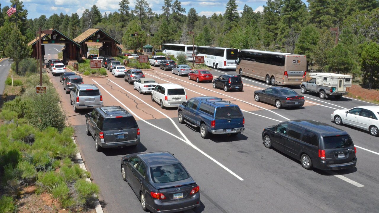
- Summer and busy seasons: NPS says lines at the South Entrance can mean waits of up to two hours between 10 a.m. and 4 p.m. during spring break, summer and fall weekends. Arriving before 10 a.m. or after 2 p.m. helps. Carry plenty of water for the desert part of the drive, and this year also for the park itself.
Frequently asked questions
How far is the Grand Canyon South Rim from Las Vegas?
278 miles (447 km) by road, according to NPS, via US-93, I-40 and AZ-64. OpenStreetMap route calculators give 275–282 miles from the Strip to Grand Canyon Village.
How long is the drive from Las Vegas to the South Rim?
About 4 hours 40 minutes to 5 hours 25 minutes without stops (OSRM and Valhalla estimates, 28 October 2026). With fuel and meal stops, plan for 5 to 6 hours each way.
Can I do Las Vegas to the South Rim as a day trip?
Yes, but it means roughly 9.5 to 11 hours of driving in one day, before any stops. With in-park lodging suspended through at least 19 November 2026, a night in Tusayan or Williams is the other option.
Is the West Rim the same as Grand Canyon National Park?
No. Grand Canyon West, with the Skywalk, is run by the Hualapai Tribe on its reservation, about 130 miles from Las Vegas. National park passes are not accepted there.
Do foreigners pay more at the South Rim?
Yes. NPS charges non-US residents aged 16 and over an extra $100 per person on top of the $35 vehicle pass, unless they use an annual or America the Beautiful pass. See our Grand Canyon tickets guide for the full fee table.
Related guides
- Grand Canyon National Park tickets, fees and passes
- US national park fee for foreigners ($100 nonresident fee)
- Upper Antelope Canyon, another Arizona canyon often combined with a Las Vegas trip
- Zion to Bryce Canyon distance
- Where to stay in Death Valley National Park
Sources (checked 28 October 2026)
- NPS Grand Canyon: South Rim directions (updated 12 Sep 2026), Fees & Passes, Alerts & Conditions (updated 26 Oct 2026), Weather and road conditions, Basic information, Shuttle buses
- NPS news releases: overnight lodging closure (30 Aug 2026), projected water restoration dates (19 Sep 2026), trails reopen (26 Oct 2026)
- NPS Nonresident fees
- Xanterra (South Rim lodges): Flooding and lodging update (updated 13 Oct 2026)
- ADOT bulletins: US-93 Kingman (13 Aug 2026), I-40 east of Kingman (26 Oct 2026), SR-64 north of Williams (14 Oct 2026)
- Bureau of Reclamation: Hoover Dam directions and parking (updated 29 Jul 2026)
- Grand Canyon West (Hualapai Tribe): FAQs and Plan Your Visit
- NIST: Daylight Saving Time
- Route calculations: OSRM (router.project-osrm.org) and Valhalla (valhalla1.openstreetmap.de), OpenStreetMap data, 28 Oct 2026
